A SAR-based flood mapping approach: application of SAR-SIFT registration and modified DeepLabV3 segmentation in flood hazard assessment
17 Jun 2025Zhang, Z., Xiong, J., Li, X., Li, Y., & Liu, J. (2025). A SAR-based flood mapping approach: application of SAR-SIFT registration and modified DeepLabV3 segmentation in flood hazard assessment. Geocarto International, 40(1), 2512188.
1. The highlight of this article
-
Proposes an automated, high-resolution flood mapping framework using SAR satellite imagery, SIFT feature-based registration, and a modified DeepLabV3+ deep learning segmentation model.
-
Demonstrates that the model is effective in detecting flood extents even in complex urban and vegetation-covered environments, outperforming traditional unsupervised methods.
-
The approach provides timely and accurate flood hazard assessment that can assist in emergency response and planning.
2. Study area and dataset
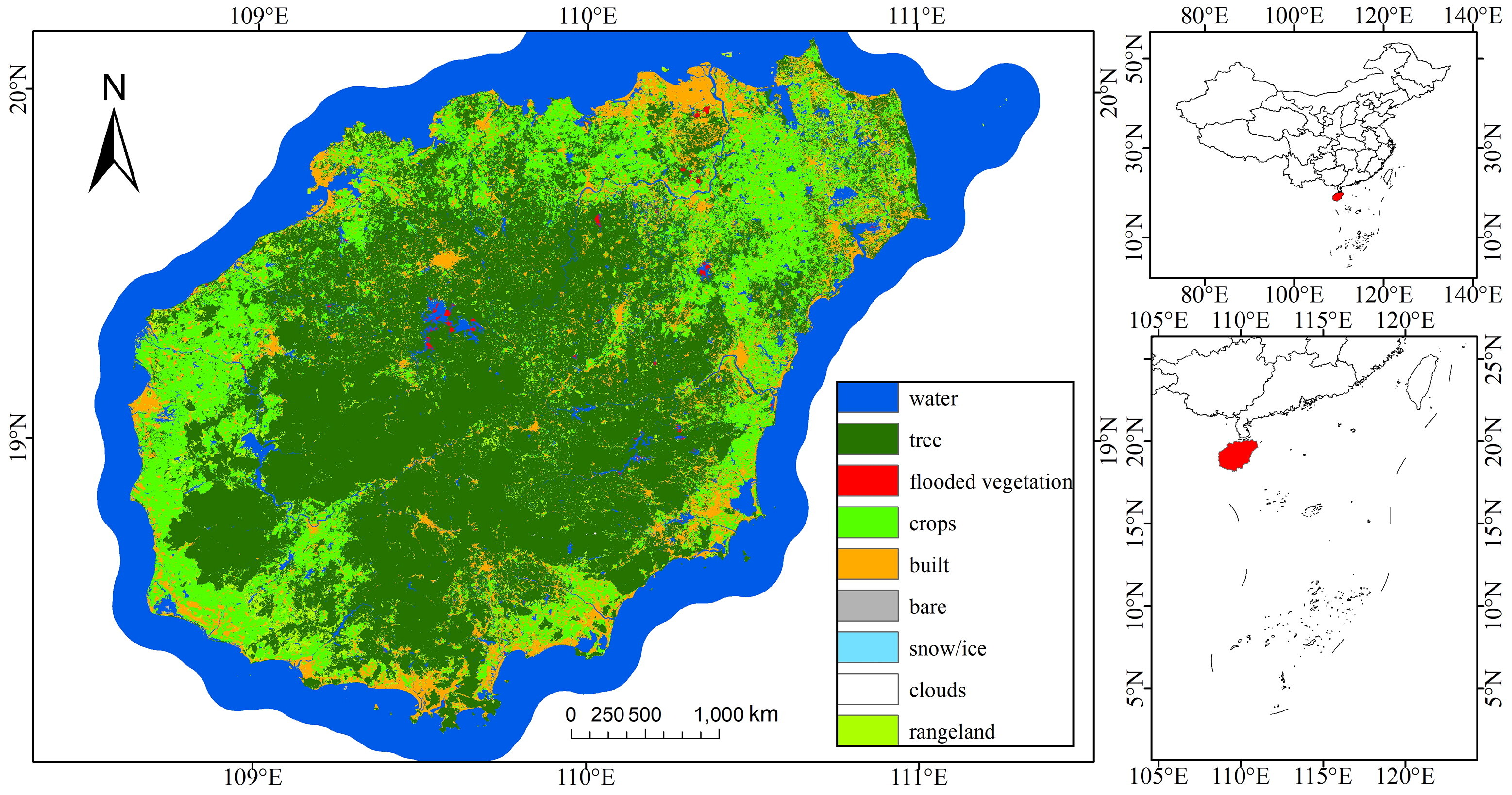
Study Area: Hainan Province, China, which experienced severe flooding from August 29 to September 1, 2022.
Focused on areas affected by Typhoon Ma-on, including both urban and agricultural zones.
Data Sources:
Sentinel-1 SAR imagery: Dual-temporal VV polarization (10 m resolution), pre-flood (August 23) and post-flood (August 31) scenes, sourced from ESA Copernicus Open Access Hub.
Sentinel-2 optical imagery: Used for reference and labeling.
Land cover data from the Chinese Academy of Sciences (CLCD).
Manual labeling of flooded areas based on Sentinel-2 images and field knowledge, used to create ground truth masks.
3. Methods
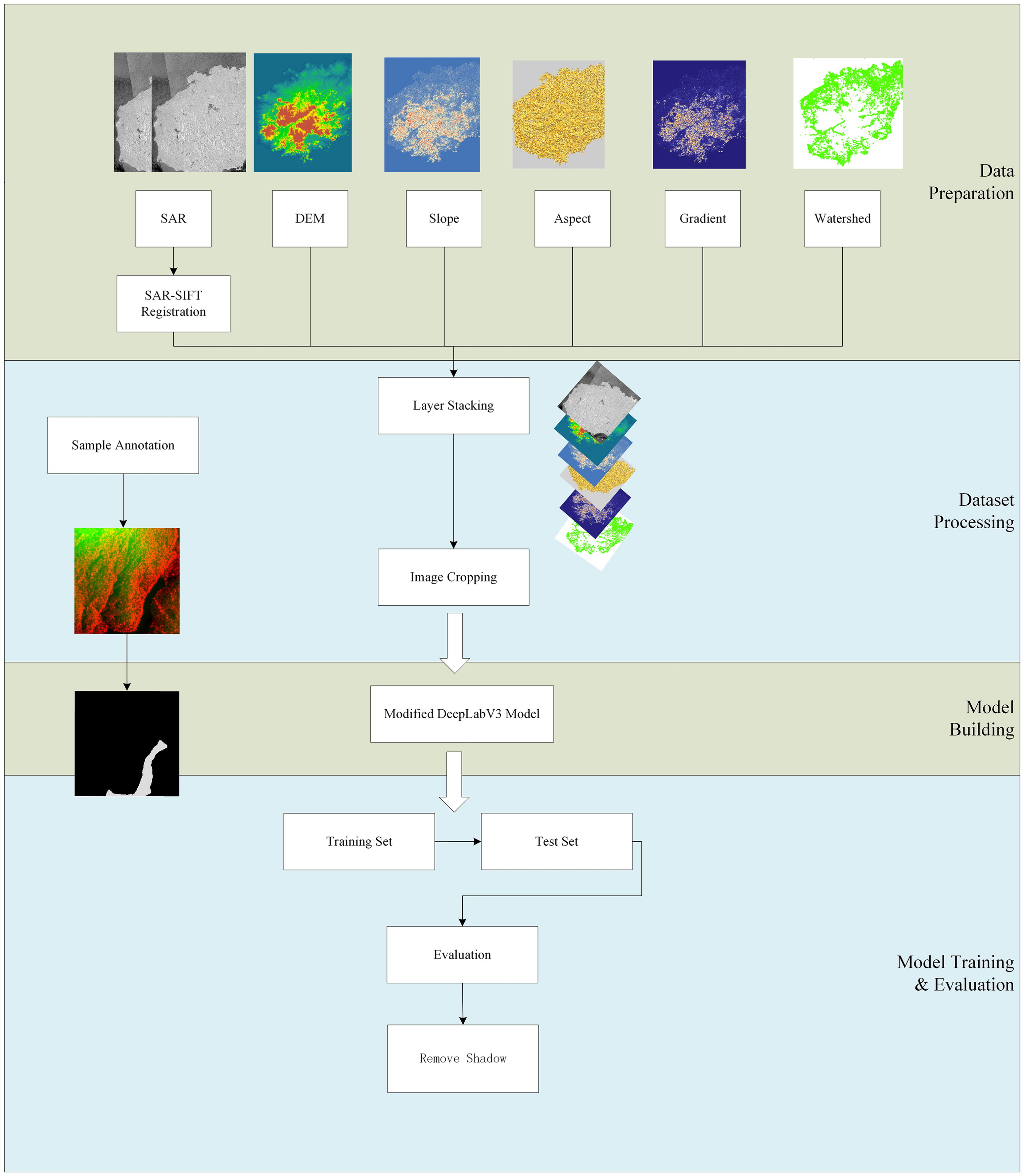
The proposed SAR-based flood mapping framework includes:
- SAR-SIFT Image Registration:
SAR-SIFT algorithm used for co-registration of multi-temporal SAR images.
Improves alignment accuracy and maintains local details better than conventional correlation-based approaches.
- Modified DeepLabV3+ Model:
DeepLabV3+ with a ResNet-101 backbone is modified to handle binary segmentation of flooded vs. non-flooded areas.
Input: dual-temporal SAR image composites (pre-flood + post-flood).
Ground truth masks are generated from manual interpretation of Sentinel-2 and FEMA data.
Model trained with data augmentation and evaluated using precision, recall, F1-score, and IOU metrics.
- Comparison with Unsupervised Methods:
Benchmarked against change detection techniques (e.g., logarithmic ratio, histogram thresholding).
Also compared to raw DeepLabV3+ without SAR-SIFT registration.
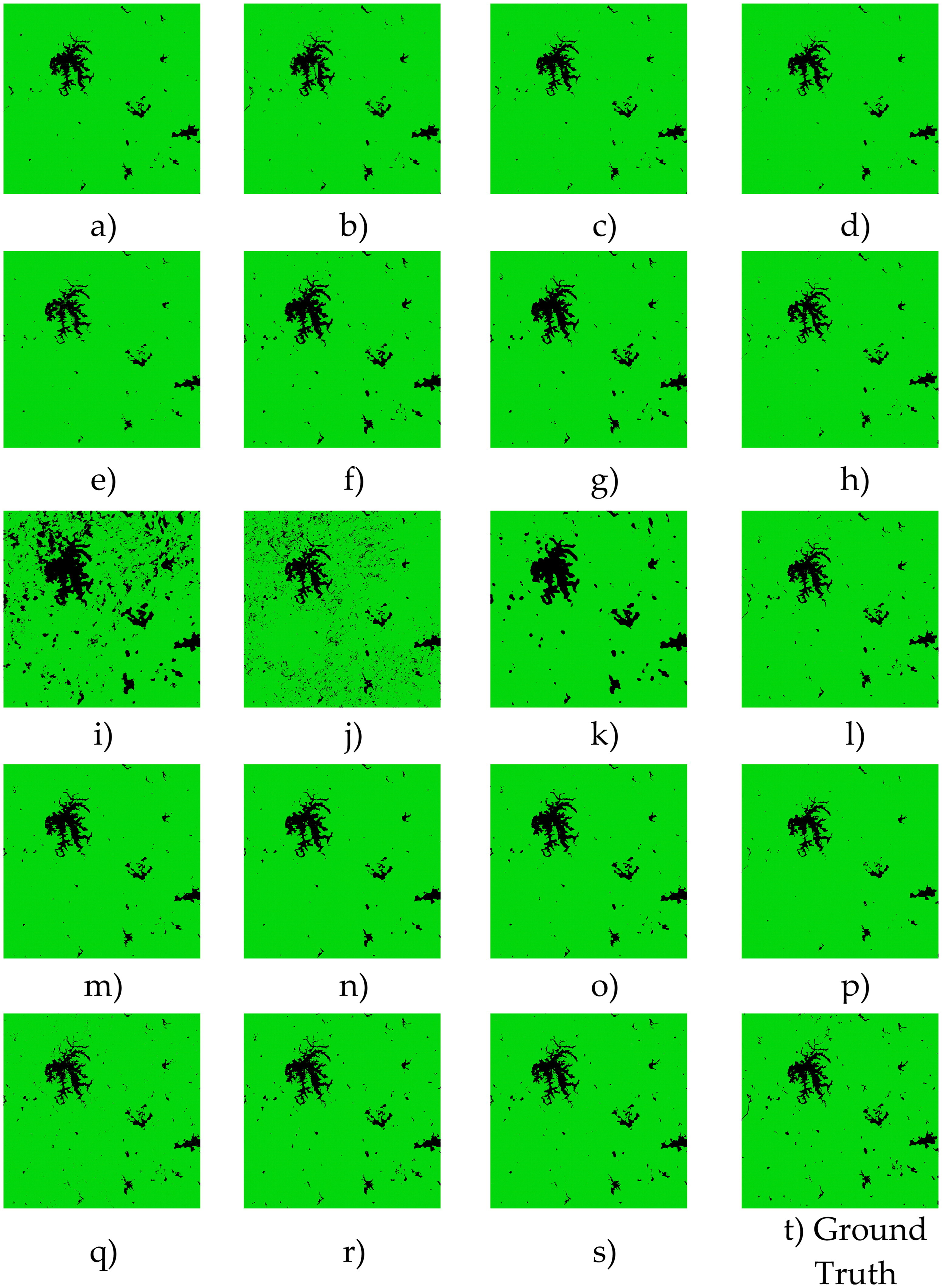
4. Results
SAR-SIFT Performance:
Achieved better co-registration accuracy than OpenCV and ENVI methods, with lower RMSE and misalignment.
Flood Segmentation Accuracy:
The modified DeepLabV3+ model with SAR-SIFT registered inputs achieved:
F1-score: 0.853, IOU: 0.743
Outperformed unsupervised methods (e.g., F1-score of histogram thresholding ~0.4).
Visual Accuracy:
The deep learning-based method produced flood maps that aligned better with FEMA boundaries, including in urban areas and complex terrains.
Generalizability:
The workflow is modular and scalable to other regions and flood events using SAR imagery.